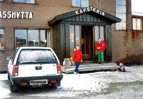
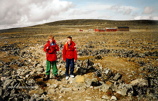
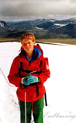
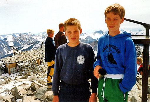
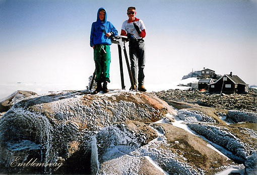
Magnus og Erling utenfor Juvasshytta,
klare for å bestige Galdhøpiggen. 11. juli 1992
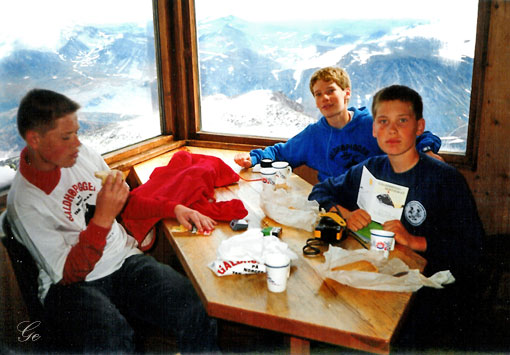
Juvasshytta ligger nord i Jotunheimen og er nærmeste hytta til Galdhøpiggen. Hytta har flott utsikt mot Galdhøpiggmassivet og Glittertinden blant annet. Det er daglig føring over Styggebrean
til Galdhøpiggen i sommersesongen. Hytta er Norges nesthøyestbeliggende turisthytte.
Juvasshytta (ut.no)
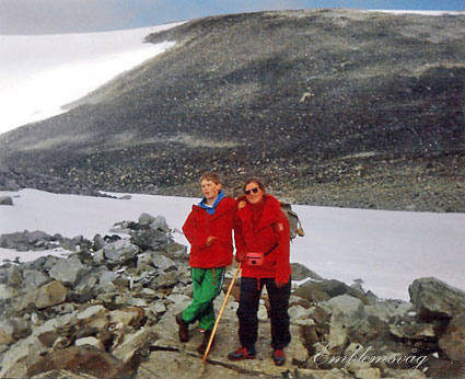
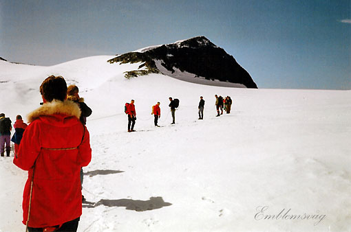
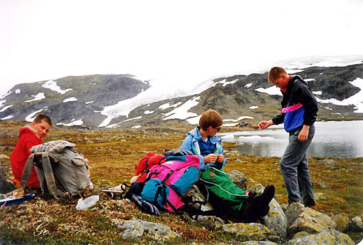
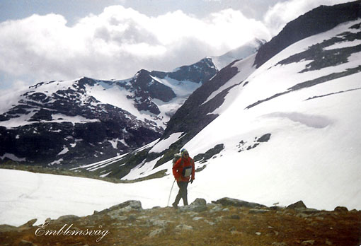
På vei til Galdhøpiggen
Juvasshytta is a mountain tourist station with restaurant and accommodation, located in Jotunheimen, in Lom municipality, Norway.
It is located at an elevation of 1,841 metres (6,040 ft), and is accessible
by road, the highest road in Northern Europe. There is a public bus connection from Lom. Juvasshytta is used as a base station for walks to
the summit of Galdhøpiggen, at 2,469 metres (8,100 ft) elevation, the highest mountain in Northern Europe. The area and the road is usually open from May to September, and closed the rest of the year.
Juvasshytta was originally built in 1884. The road was built in 1936.
Juvasshytta - Wikipedia
 |
The Styggebreen
Glacier Route is the shortest
way - but not the easiest - to reach the summit of Galdhøpiggen, with a difference of level of 600 meters: an easy and straightforward route, rising from the North-Eastern side and very |
| popular - like the normal one
from Spiterstulen - but involving a complete
glacier's equipment. As a matter of fact this route is a superb and satisfactory ascent crossing the Styggebreen, |
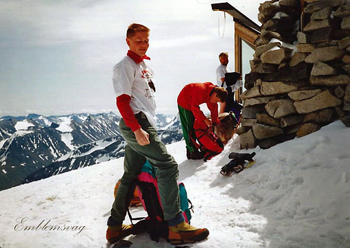
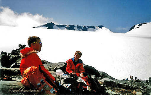
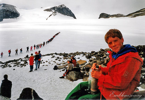 En rast før vi begynner på Styggebreen |
early season or after summer snowfalls. In the upper section the route follows a rocky and snowy ridge, then rises along easy snow-slopes to
the little summit stone-shelter and finally to the top.
Styggebreen Glacier Route/Galdhøpiggen : Climbing, Hiking & Mountaineering : SummitPost
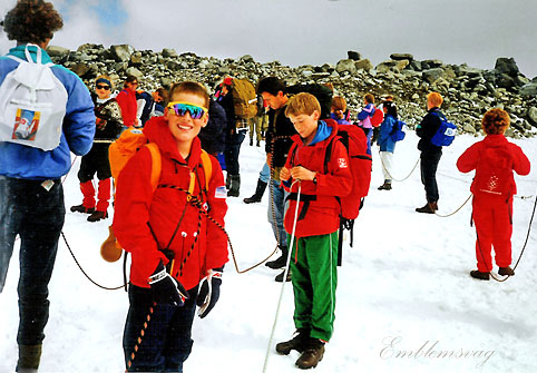
Taulaget klar til å gå over breen
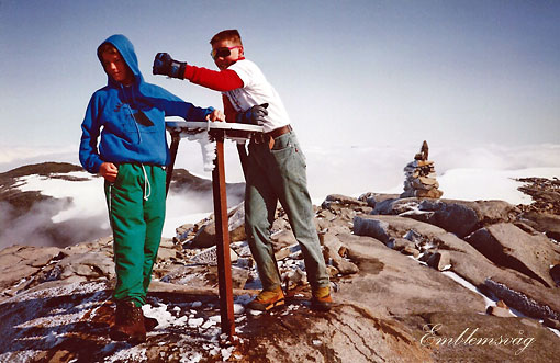
Galdhøpiggen 2469 moh
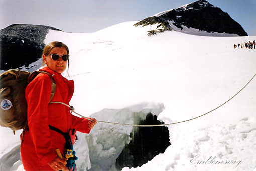
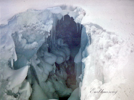
Sprekk i isen
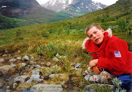
 Erling på breen |
Galdhøpiggen
is Northern Europe’s highest mountain, reaching
2469 meters above sea level. The mountain is a national symbol of Norway situated in the heart of Norway - in the middle of the alpine and breath taking nature in Jotunheimen National Park. Hiking to Galdhøpiggen is one of the country's most popular mountain hikes, and can be done both in the summer and in the winter with skis. About the hike The trip can start from the Juvasshytta, above the Styggebrean as a guided |
the glacier.
Galdhøpiggen - Jotunheimen (visitjotunheimen.com)
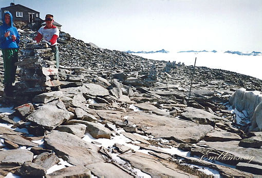
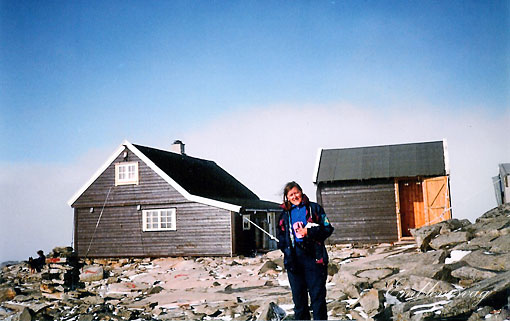
Vi er på toppen
Geir utenfor hytta på toppen
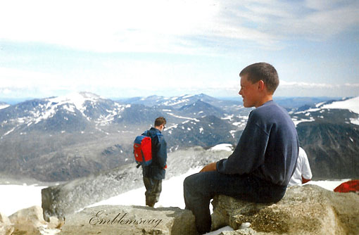
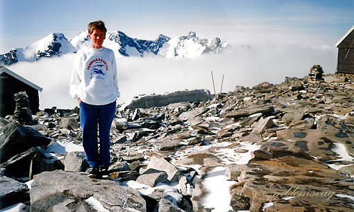
Magnus beundrer utsikten fra toppen
Inne på hytta på toppen.
Fra Galdhøpiggen gikk vi ned til Spiterstulen.
Der ble vi en dag, 12. juli.
Den 13. gikk vi opp til Juvasshytta henta bilen og kjørte til Leirvassbu.
Den 14. kjørte vi til Krossbu og gikk derfra til Skogadalsbøen
Bildet er tatt på vei fra Krossbu til Skogadalsbøen
Vi nærmer oss Skogadalsbøen
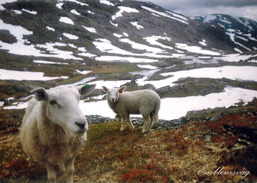
Mye snø og mange sauer i fjellet
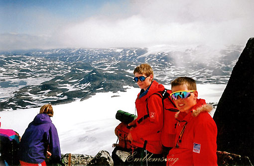
Grete i Keisarpasset 15. juli 1992
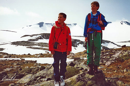
På Fannaråken
Fannaråki (or Fannaråken) is a mountain in the municipality of Luster in Vestland county, Norway. The 2,068-metre (6,785 ft)
tall mountain is located in the Jotunheimen National Park, just
south of the lake Prestesteinsvatnet and the Sognefjellsvegen road.
The first element is derived from the word fonn which means "glacier made of snow" and the last element is the finite form of råk
which means "mountain ridge"
Fannaråki - Wikipedia (18. august 2023)
Fannaråkhytta
16. juli gikk vi over Fannaråkbreen ned til Krossbu.
Taulaget ordnes før vi skal over breen.
Fannaråken i bakgrunnen
 Rommet vårt på Krossbu |
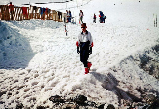
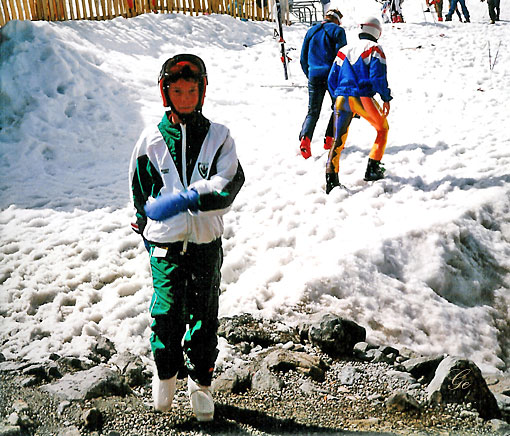
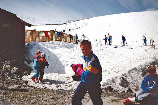
Den 17. juli kjørte vi opp til Juvasshytta og tok en dag i slalåmbakken. About 1 kilometre (0.62 mi) from Juvasshytta, there is the Galdhøpiggen Summer Ski Centre, a small ski resort, which is open all summer. It has a height of 350 metres (1,150 ft) with a top altitude of 2,200 metres (7,200 ft). There is one ski lift and two pistes. Juvasshytta - Wikipedia |